
Horseshoe Bend

Near Page, AZ
HORSESHOE BEND
A BRIEF SUMMARY OF HORSESHOE BEND
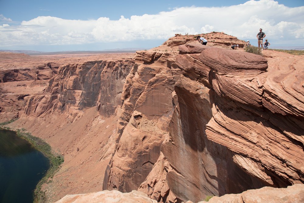
Horseshoe Bend is not like any other place on earth. It’s one of those amazing places where pictures simply don’t do justice to the reality. When you first walk up to the rim of Horseshoe Bend you cannot believe how unbelievably large the bend is, and it takes you a few minutes to wrap your mind around what is in front of you. The horseshoe shaped river sits 1,000 vertical feet directly below you and the bend is over a mile long.
It is understandable why thousands upon thousands of tourists from all over the world visit this location each year. And from a photographic standpoint, it should be a must for your portfolio. You will not be disappointed.
Images and location summary by Tim Wier

Annual Subscription
Lifetime Membership
DATA POINTS INCLUDED WITH HORSESHOE BEND SUMMARY
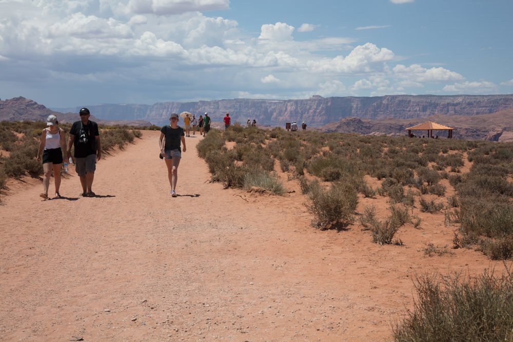
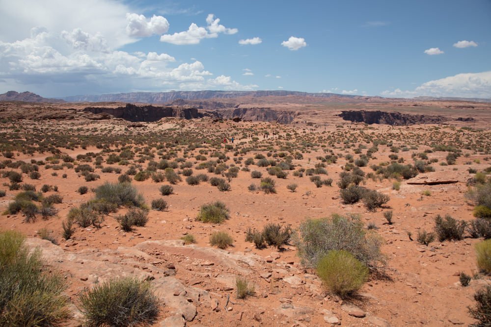
I would rate the difficulty of this trail as a 2.5 on a scale of 1-5 (with 5 being most difficult). The hike from the parking lot to the rim is a well-marked sandy ¾ mile trail. The hike has an incline of about 100 feet to the top of the trail, and then a 200ft. decent down to the rim. As mentioned, the trail is sandy, so wear boots or shoes and just take your time.
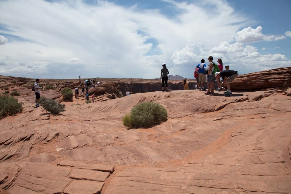
The ledge on the rim is 1,000ft. straight down to the river. A fall would be fatal, so always be careful.
As mentioned, the scale (height, depth, and width) of Horseshoe Bend is larger than you can imagine before visiting. Trying to compose is difficult to impossible without an ultra wide lens.
For sunrise, the best light lasts for only a few (30 or so) seconds after the sun hits the back walls of the Vermilion Cliffs. If the sunrise it blocked, it is dead shot and you will have to try again another day. However, if you catch this just right, it can make for a stunning image. The differences in dynamic range are extreme, so you may need to blend multiple images together or use HDR software.
For sunset, in the spring/summer months, the sun will set directly in front of the river bend. From a photographic standpoint, it is always best with clouds or a thunderstorm. If you get lucky and hit the right conditions, you can get a GREAT image.
You need an ultra wide 11-16mm lens to capture the full view of the scene. Without an ultra wide lens, you will have to stitch multiple shots together.
4,205 Ft. Elevation
Other Resources Available with Membership
KMZ Trail File
Directions
Best Time of Day to Shoot
Best Time of Year to Shoot
Equipment Needed
Permits Required
Direction of Shot
Google Maps Birds-Eye-View
Number of Photographers to Expect
Cell Service
Overnight Lodging/Camping
Nearby Restaurants
Area Guides and Workshops
Other Resources
LOCATION SUMMARIES WRITTEN BY PROFESSIONAL PHOTOGRAPHERS


