
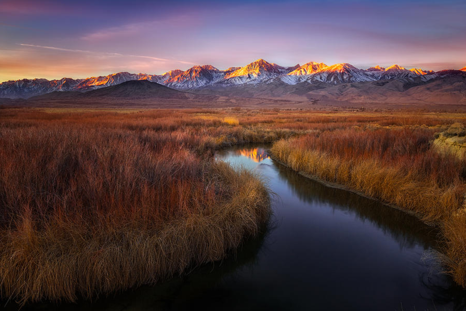
Owens River Sunrise

OWENS RIVER SUNRISE
Near Big Pine, CA
The Owens Valley, with its meandering river, endless sage and surrounding mountain ranges (Sierra, White and Inyo) was a favorite area of the legendary Galen Rowell. This amazing valley can provide days filled with great photographic opportunities and is an easy drive to Eureka Dunes, Alabama Hills, The Ancient Bristlecone Pines, Mammoth Lakes, Death Valley, Mono Lake and the Tioga Pass to Yosemite.
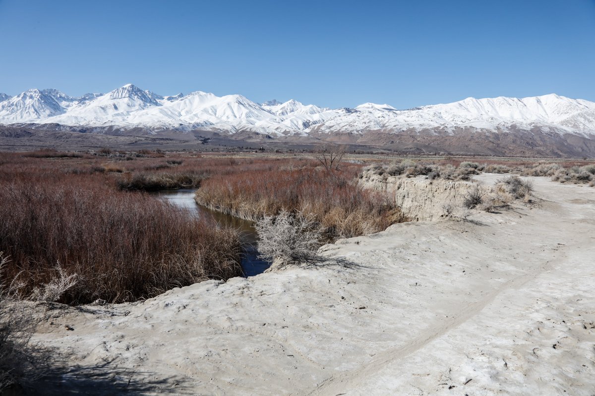
The shot above was taken at one of the many S curves along the Owens River near the little community of Big Pine, CA. After a strong snow storm hit the area, I wanted to find a location that captured the valley with the Sierra’s in the background. After driving around and hiking for a few hours, I stumbled upon this spot - which was literarily in the middle of a cow pasture. The following morning, I was able to capture this shot just as the sun peeked through the clouds - right before I received an early morning visit from a mama cow and their calf.
Images and location summary by Tim Wier
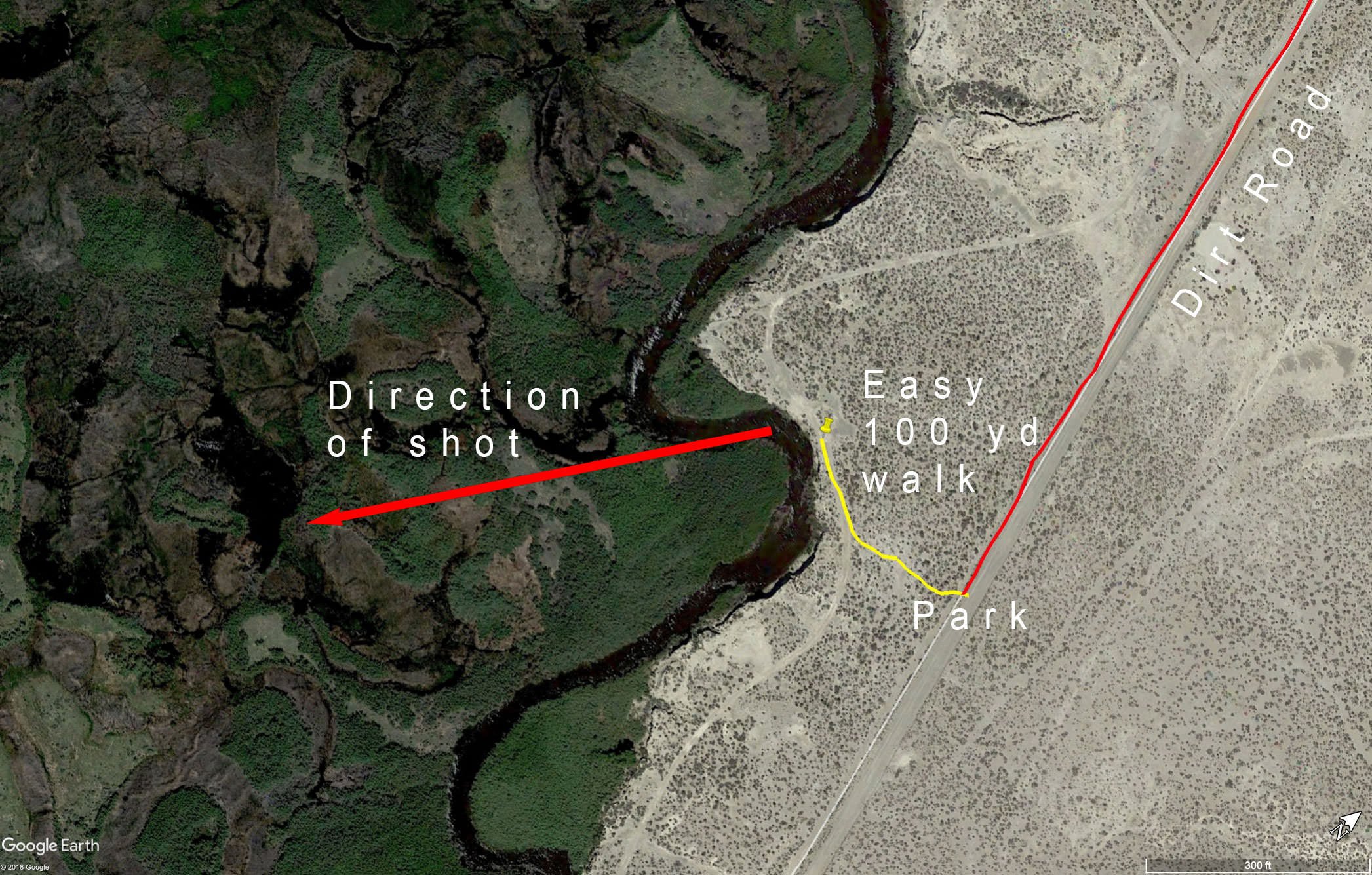
Trail Difficulty - EASY
I would rate the difficulty of this trail as a 1 on a scale of 1-5 (with 5 being most difficult). The hike to this location is an easy 75 yds from the dirt road just east of Big Pine, CA. The only concern is being approached by one of the cows grazing in and around this area.
GPS Coordinates & Elevation
4,150 Ft. Elevation
View In Google earth
Download KMZ Trail File
Click Here to download the KMZ file for this location.
Directions
CLICK HERE to get driving directions to the parking area for Owens River Sunrise
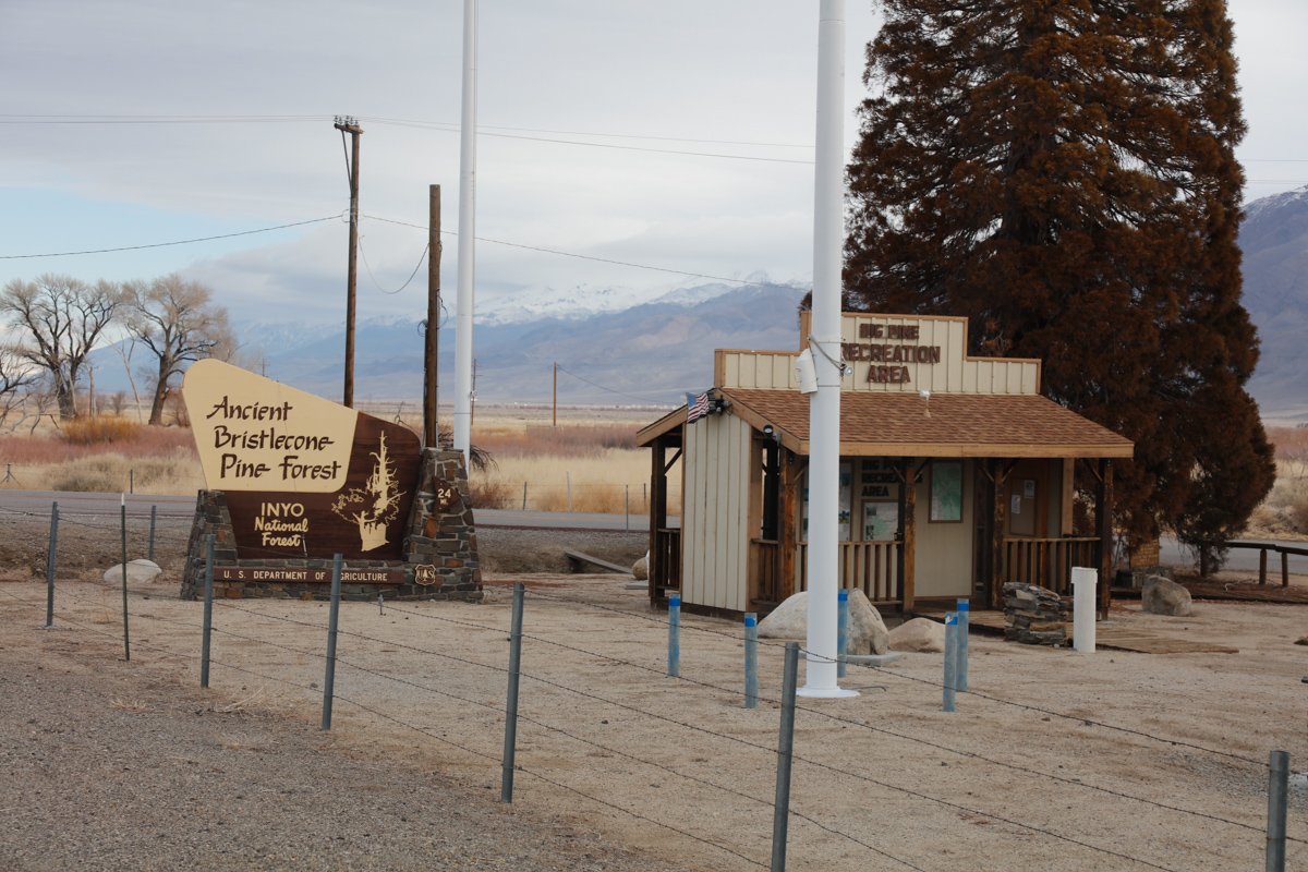
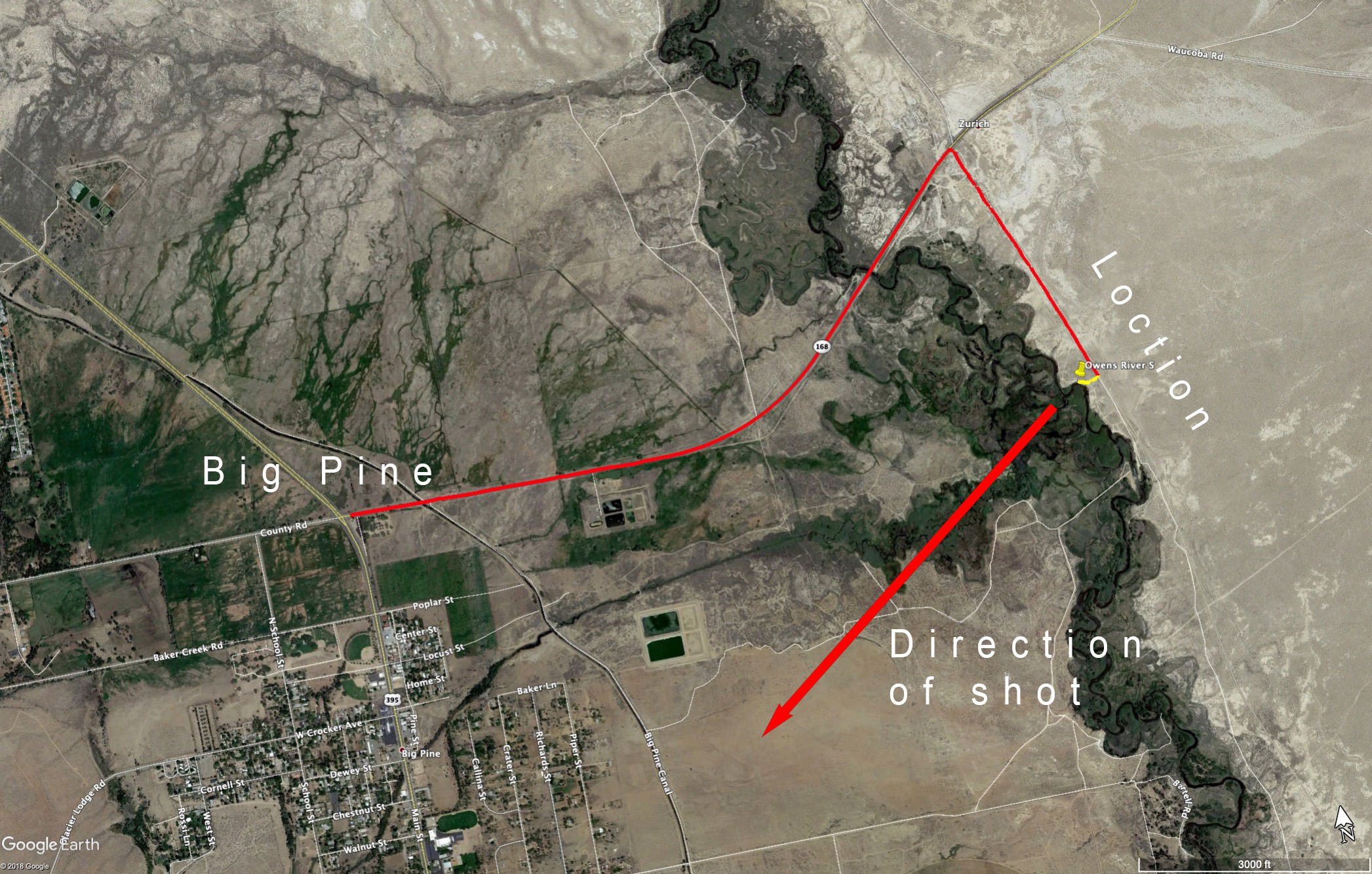
This shot is located south of Bishop, CA. From Bishop, drive south on US-395 for about 14 miles and turn left (east) on CA 168-E just before the small town of Big Pine, CA. Travel east for 1.9 miles and turn right on an unnamed dirt road just before the community of Zurich.
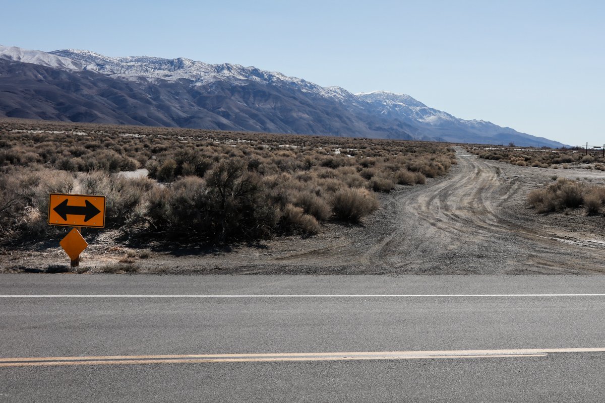
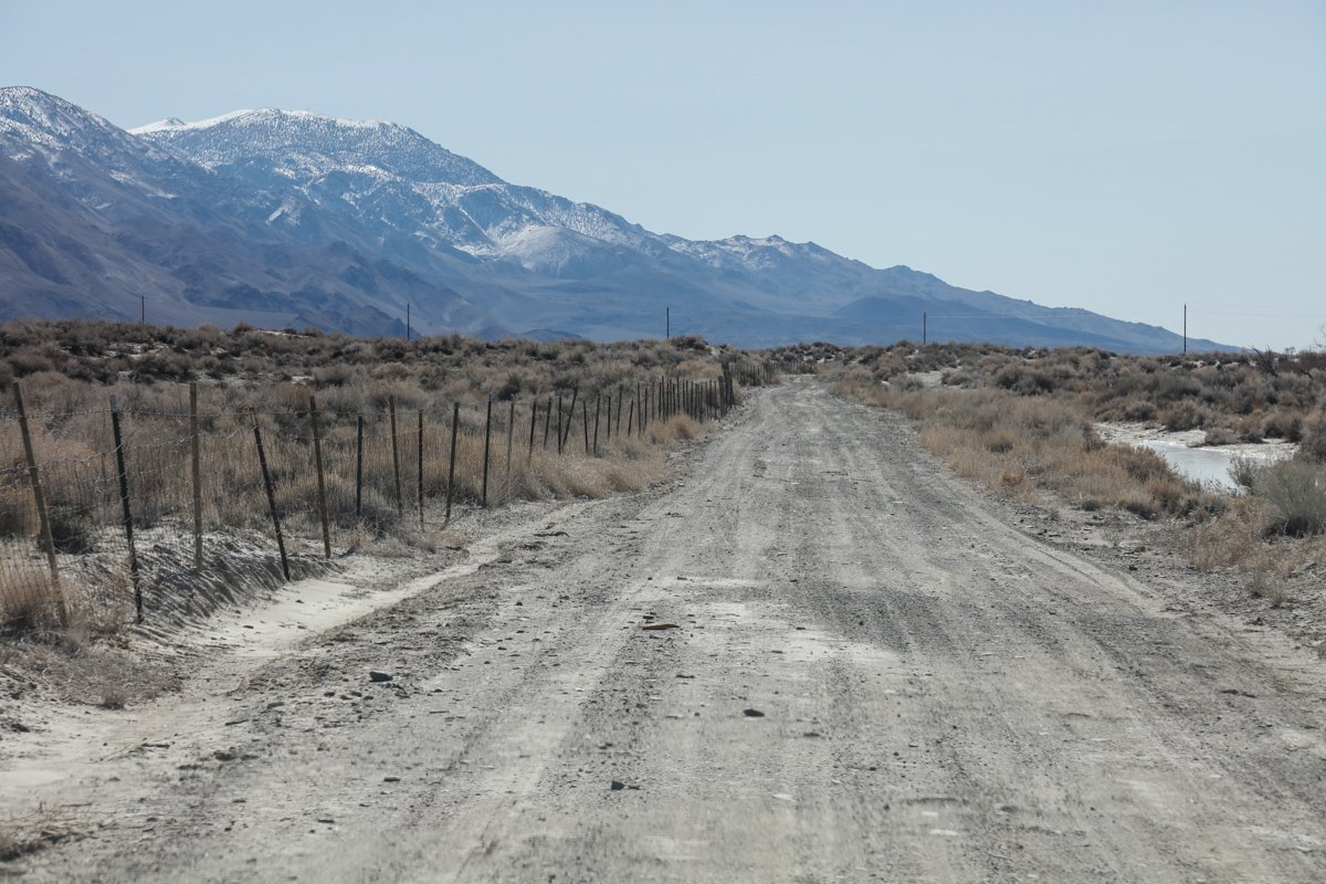
After crossing a small bridge over the Owens River (on CA168-E) look for a dirt road with the sign shown below. Take a right on the dirt road and drive for .7 miles and park. There are no markers, just walk west toward the mountains and in about 100yds you will come to the river. Walk around until you find the shot shown below.
Photography Tips
For the most part, this shot is pretty straight forward. However, it is VERY IMPORTANT to get the angle of the curve correct - or it will loose its effect. Too much or too little of the river will loose the effect of the curve. Just take your time and focus on the S in the river.
This shot is all about the light, so make sure you are ready when the sun illuminates the peaks of the Sierras.
EXIF Data
Focal Length – 24 mm
Exposure – 1/4 th sec @ f 8.0
ISO – 35
Date – Feb 20th
Time – 6:36 am
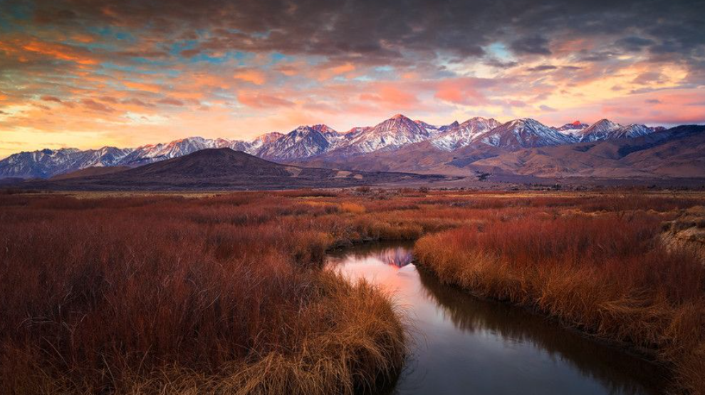
Other Images From This Location
Best Time of Day to Shoot
In my opinion this is a sunrise shot. The shot faces west for sunset, but the lights of the Big Pine will distract for a sunset shot.
Best Time of Year
I believe you can shoot here anytime of year. However, I really like the snow on the Sierra’s, so I prefer the winter months. The sage and grass in the foreground are fine even in the dead of winter.
Lens(es) Needed
The shot above was taken with a 24mm lens.
Birds-Eye View
Permits
There are no permits required.
Direction of the Shot
The direction of the shot is west around 250°.
Equipment Needed
Other than a tripod, there is no need for any special photography. If you have a tilt/shift lens, I would use it here to compensate for the slight keystone effect while pointing down toward the river.
Number of Other Photographers to Expect
This spot is off the beaten path and it would be rare to see anyone else at this location.
Weather
The Owens River Valley is set between the Sierra and Inyo mountains and is desert area. The highs are warm in the summer and it can get pretty cold in the winter too.
Cell Service
I have Verizon and I had cell service at this location.
Lodging & Camping
There are 2 motels in Big Pine - and as mentioned this location is only about 14 miles south of Bishop, CA, which has an abundance of lodging. There is a nice campground in Big Pine just down the road from the shot and several other campgrounds around Bishop.
Nearby camping and lodging
Camping - click on the campground below for directions
Glacier View Campground (at US 395 and CA68 in Big Pine )
Browns Millpond Campground (near Bishop)
Horton Creek Campground (north of Bishop)
Lodging - click on the lodging below for a TripAdvisor review
Bristlecone Motel
(760) 938-2067
101 N Main St, Big Pine, CA
Best Western Bishop Lodge
(760) 873-3543
1025 N Main St, Bishop, CA
Vagabond Inn Bishop
(760) 873-6351
1030 N Main St, Bishop, CA
Nearby Restaurants
The little town of Big Pine has a few restaurants. I have enjoyed some good BBQ at Copper Top and had a good breakfast after shooting at the Country Kitchen.
Nearby Restaurants - click on the restaurant below for yelp review
Copper Top BBQ
(760) 970-5577
310 N Main St Big Pine, CA 93514
Country Kitchen
(760) 938-2402
181 S Main St Big Pine, CA 93514
Rossi’s Place
(760) 938-2308
142 S Main St Big Pine, CA 93513
Area Guides and Workshops
None