
Bennett Bridge

BENNETT-BEAN BRIDGE
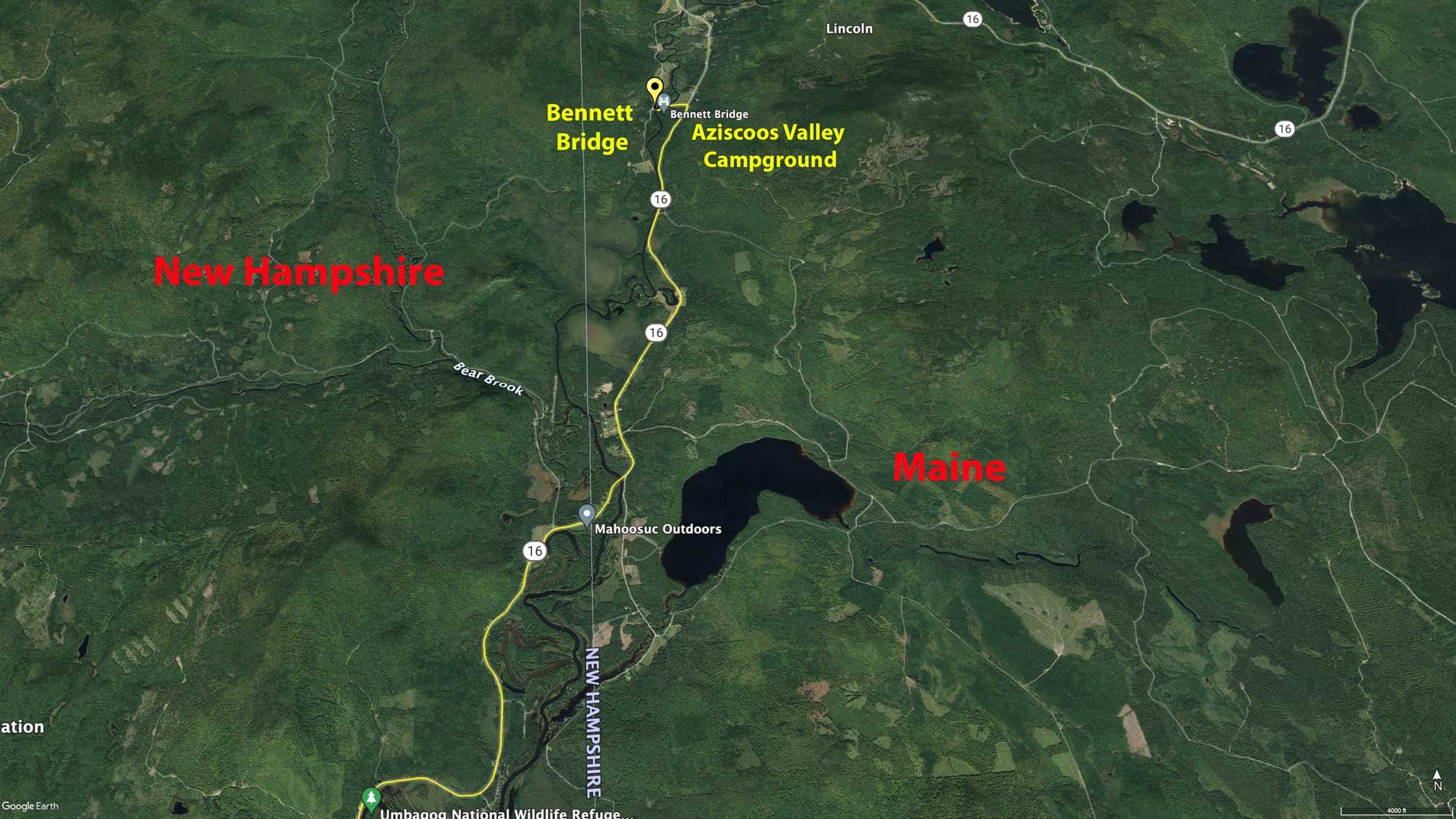
Maine/New Hampshire Border
Image by Rick Berk @ www.rickberk.com
There's nothing so New England as the covered bridges that dot the map around Vermont, New Hampshire, and Maine. One of Maine's older covered bridges, the Bennett Bridge in Errol, Maine is a classic example of a Paddleford Truss design
The bridge was built in 1901 to provide access to Maine Route 16 to a group of small farms in the area. The bridge crosses the Magalloway River at a point where it flows swiftly through a narrow valley. The bridge is 92 feet long and 16 feet 8 inches wide. It was added to the National Register of Historic Places in 1970, and closed to traffic in 1985.
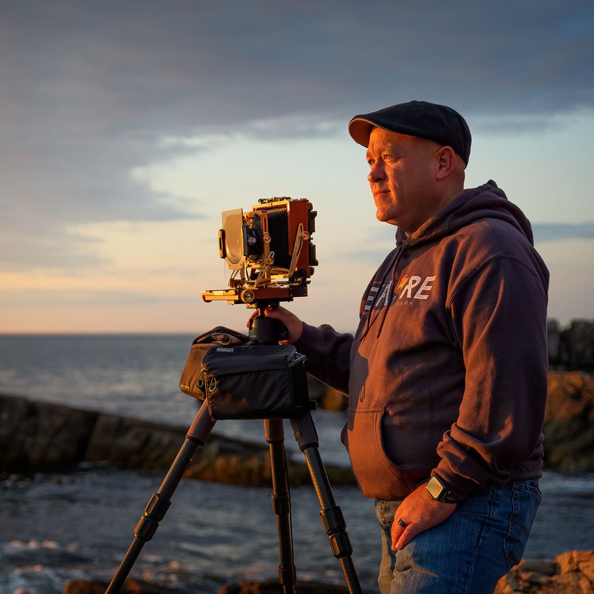
Photos and location summary by Rick Berk
Trail Difficulty - EASY
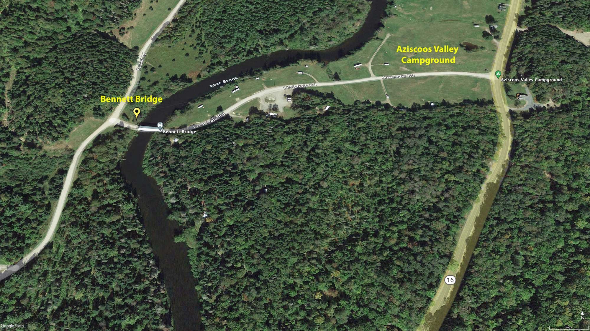
The trail is easy. From Maine Route 16, you turn onto Littlehale Road and pull off to the side as you see the bridge come into view. Simply get out of your car and walk around until you find the desired angle.
GPS Coordinates & Elevation
1,267 Ft. Elevation
View In Google earth
Directions
CLICK HERE to get driving directions to Bennett Bridge
From Bethel, ME - take US-2 East for 5.9 miles and turn left onto ME-26 North. Drive for 22.0 mi on ME-26 North (you will cross into New Hampshire) - then continue onto NH-26 West for 8.3 mi and then turn right onto NH-16 North for 8.9 miles (you will be crossing into Maine). Once crossing back into Maine on ME-16 E, drive 4.4 miles and turn left onto Littlehale Rd. (at Aziscoos Valley Campground). Once in the campground, drive .3 of a mile and you will arrive at the Bennett Bridge.
From Errol, NH - Drive north on NH-16 North for 8.9 miles and you will cross into Maine. Continue onto ME-16 East for 4.4 miles and turn left onto Littlehale Rd. (at Aziscoos Valley Campground). Once in the campground, drive .3 of a mile and you will arrive at the Bennett Bridge.
Photography Tips
I walked around quite a bit to find just the angle I was looking for. My first instinct is to go wide, but I found the extended perspective pushed the hills too far back. Using a 24-70mm at 70mm brought the hills closer in to the bridge and emphasized the color. I also used a soft, 2-stop graduated neutral density filter to help control the brightness of the trees, as the bridge itself was still in shadow. This shot was taken around 7am, just after sunrise.
EXIF Data
Focal Length – 70mm
Exposure – 1/60 sec @ f 8.0
ISO – 100
Date – Sept 26th
Time – 7:05 am
Best Time of Day to Shoot
In the morning, the rising sun will light up the hills behind the bridge, and in the evening, the setting sun will light up the sky behind the hills that back the bridge. Due to the fact that the bridge is tucked into a narrow valley, it does not get any direct early morning or late afternoon sunlight on its face. If you prefer a warm glow in the sky, late afternoon is your time, but if you prefer some light on the hills, early morning will be better. Cool mornings are a good time for mist to hang in the valley as well, providing a nice diffuser for the light.
The image above was taken around 7am, just after sunrise.
Best Time of Year
In the fall, the hillsides behind the bridge will be covered in a riot of orange, red, and yellow trees, mixing with evergreens. Lit by the morning sun it can be quite a show for the camera. From late spring through summer, the hillside will be lush and green.
The above shot was taken on Sept 26th
Lens(es) Needed
Standard length zoom lenses will work well, such as a 24-70mm. A longer lens used from further away will compress the perspective further and really tuck the bridge in among the trees.
The above shot was taken with a 70mm lens
Birds-Eye View
Permits
At this time, there are no permits required.
Direction of the Shot
The direction of the shot is northeast round 75°.
Equipment Needed
Tripod, camera, lenses, filters if desired.
Number of Other Photographers to Expect
On most days there are few to no other photographers at this location.
Weather
Cell Service
I have Verizon and cell service is spotty at this location.
Lodging & Camping
Bennett Bride is located in rural Maine on the border with New Hampshire. The bridge is located in a small rural campground called Aziscoos Valley Camping Area (open May 15 through October 15th). The campsite has 34 sites for camping along the Magalloway River. Have the campsites have water and electric, the other half are tent sites.
Phone # 207-486-3271
Area Guides and Workshops
Rick Berk (25 years as a landscape photographer) - offers private group, 1 on 1 and group workshops (BlueHour Photo Ventures) for the Maine and other northeast US area. Rick lives Freeport, Maine and has traveled and photographed the NE for most of his adult life. His outstanding work can be found at www.rickberk.com