
Cutler Bold Coast

THE CUTLER COAST
Cutler Coast Public Reserved Land, ME
Image by Rick Berk @ www.rickberk.com
The Cutler Coast Public Reserved Land offers 12,000 acres of wilderness right on the Bold Coast of Maine, featuring nearly 11 miles of trails, with 4.5 miles of trails along the headlands overlooking the Bay of Fundy. The views are some of the most spectacular along the Maine coast. Located about 2 hours from Bar Harbor and Acadia National Park, the Cutler Coast Preserved Lands is Maine Untouched - wild, rocky, and beautiful.
Due to the extensive hiking required, this area is less photographed than Acadia National Park but is no less beautiful. You're likely to encounter more hikers on the trail than other photographers. Five campsites are available on the trail on a first come, first served basis. There are no fees required for the use of the preserve.
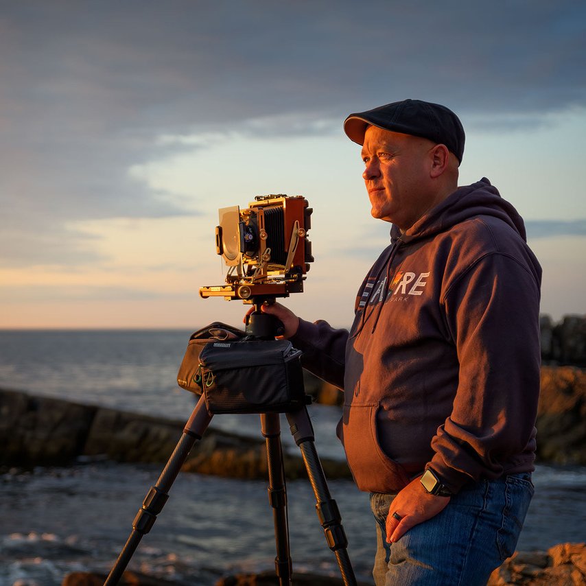
Photos and location summary by Rick Berk
Trail Difficulty - DIFFICULT
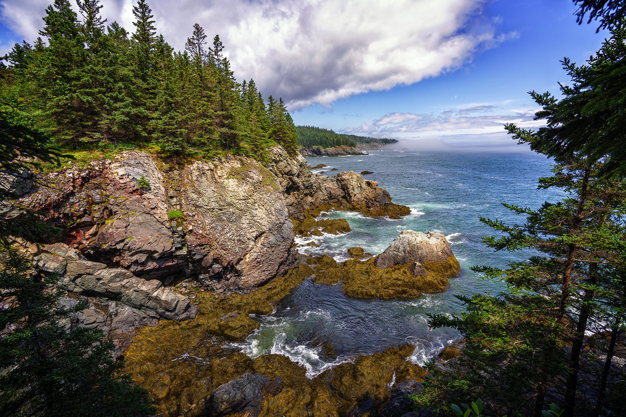
On a scale of 1 to 5, with five being the most difficult, I rate this trail a 3.5. Various trail rating systems rate the trail moderate to advanced, so be aware this isn't a walk in the park. From the parking area, you'll walk through the forest with many wood boardwalks in varying states of repair or disrepair. The trail is rocky and heavily covered in tree roots, with some sections of packed dirt and needles. The trail will be extremely muddy in places after heavy rains as well. At .4 miles, you reach a junction for the Inland Trail and the Coastal Trail. The Inland Trail veers right and travels through a bog and wetlands, which at times can be flooded and difficult to traverse. Staying to the left at the junction puts you on the Coastal Trail. Another mile down the trail and you reach the cliffs and the beginning of 4.5 miles of trails along the headlands.
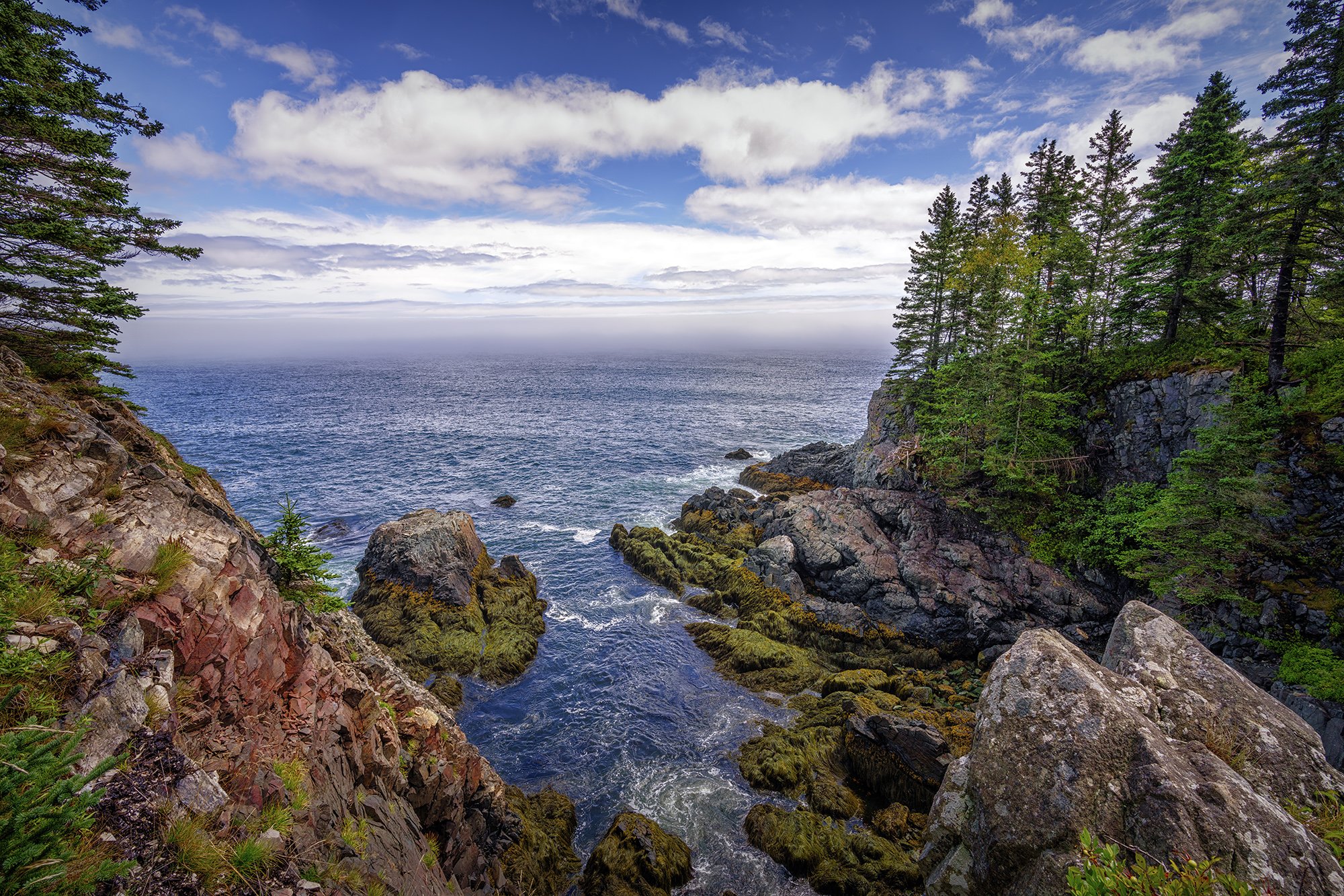
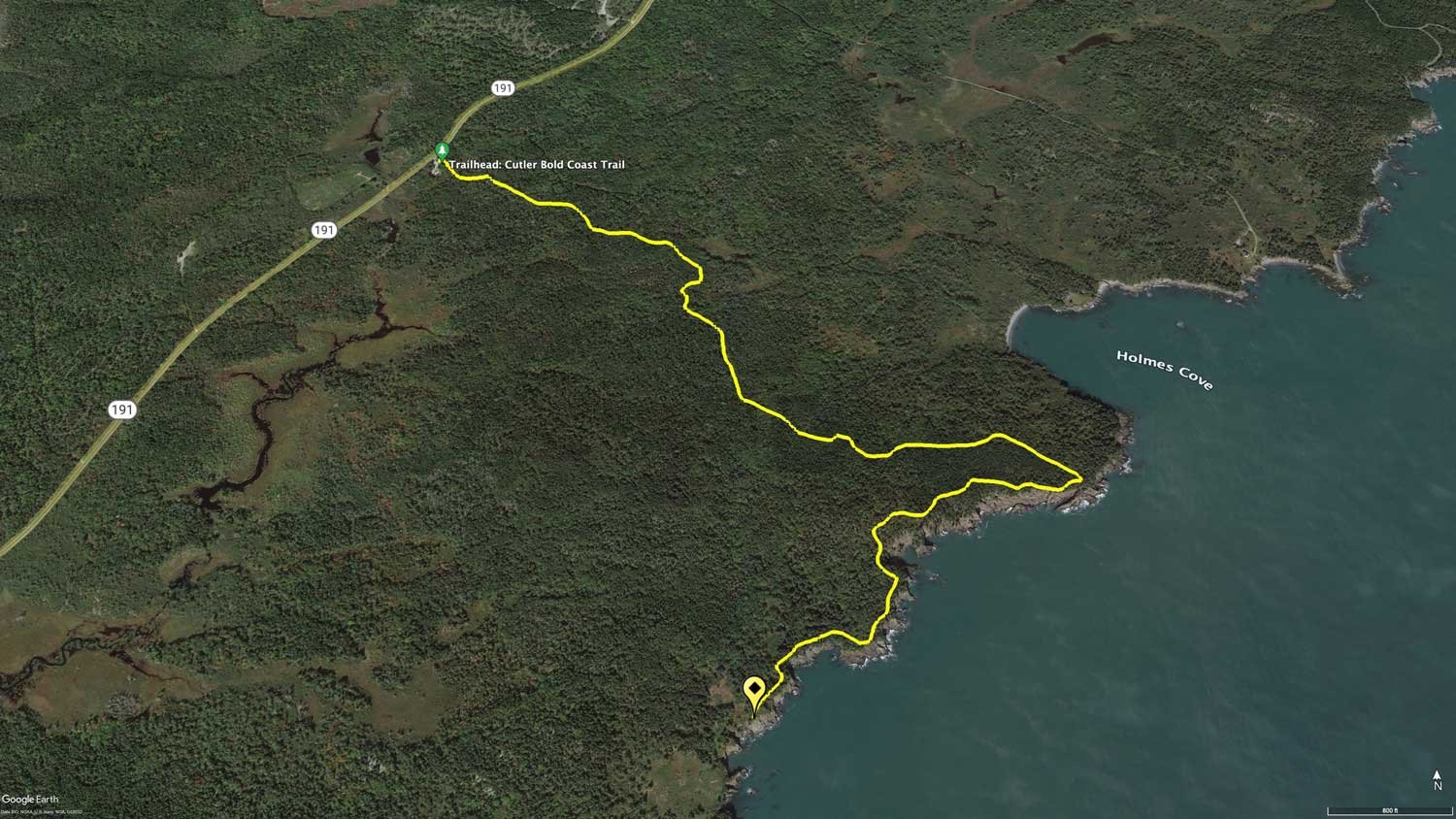
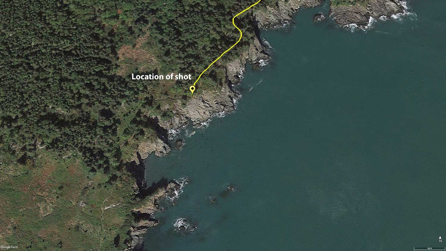
The trail can be hiked three ways. You can follow the coastal trail out and back, which will make this about a 7 mile round trip. You can hike the Black Point Brook Loop, which is a 7 mile loop, the return being over the Inland Trail through the bog. Finally, you can follow the Fairy Head Loop, which covers the entire 4.5 miles of headlands along the cliffs with stunning water views, with the return through the bog over the Inland Trail. The Fairy Head Loop is just over 11 miles long. The location of this image approximately 4 miles along the Coastal Trail.
GPS Coordinates & Elevation
150 Ft. Elevation
View In Google earth
Download KMZ Trail File
Click Here to download the KMZ file for this location.
Directions
CLICK HERE to get driving directions to Cutler Coast Public Reserved Land Trailhead
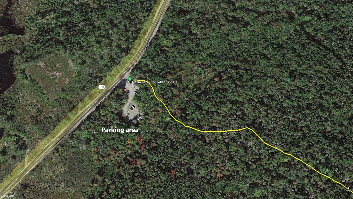
From Bangor, ME - Take State Rte 9 for 65 miles until you get to Wesley. From Wesley take ME-192 S for 18.2 miles to Machias. From Machias, drive on US-1 N for 3.5 mi until you reach East Machias, ME, from there turn right onto Willow St for 0.1 miles and then turn right onto Water St and travel 0.2 miles until you hit Turn right onto ME-191 S. On ME-191 S, turn right and drive 16.5 miles and the small parking area will be on your right.
From Machias, ME - drive on US-1 N for 3.5 mi until you reach East Machias, ME, from there turn right onto Willow St for 0.1 miles and then turn right onto Water St and travel 0.2 miles until you hit Turn right onto ME-191 S. On ME-191 S, turn right and drive 16.5 miles and the small parking area will be on your right.
I would strongly suggest downloading a GPS / hiking app to your smart phone and plot the GPS coordinates. The GPS / hiking apps I use are Alltrails or Gala GPS. You can download the KMZ trail file ABOVE to help from getting lost.
From the parking area/trailhead, you'll walk through the forest with many wood boardwalks in varying states of repair or disrepair. The trail is rocky and heavily covered in tree roots, with some sections of packed dirt and needles. The trail will be extremely muddy in places after heavy rains as well. At .4 miles, you reach a junction for the Inland Trail and the Coastal Trail. The Inland Trail veers right and travels through a bog and wetlands, which at times can be flooded and difficult to traverse. Staying to the left at the junction puts you on the Coastal Trail. Another mile down the trail and you reach the cliffs and the beginning of 4.5 miles of trails along the headlands.
The trail can be hiked three ways. You can follow the coastal trail out and back, which will make this about a 7 mile round trip. You can hike the Black Point Brook Loop, which is a 7 mile loop, the return being over the Inland Trail through the bog. Finally, you can follow the Fairy Head Loop, which covers the entire 4.5 miles of headlands along the cliffs with stunning water views, with the return through the bog over the Inland Trail. The Fairy Head Loop is just over 11 miles long. The location of this image approximately 4 miles along the Coastal Trail.
Photography Tips
There are many opportunities to make photos along the Coastal Trail, and even on the Inland trail. For this particular photo, fog was moving in off the water, adding some mystery to the coastline. I chose to go with a long exposure of 25 seconds here, using a polarizer to reduce glare off the surface of the water, and to eliminate some of the haze caused by the fog.
EXIF Data
Focal Length – 52 mm
Exposure – 60th sec @ f 8.0
ISO – 100
Date – June 8th
Time – 4:45 pm
Other Images From This Location
Best Time of Day to Shoot
Early morning is best. Sunrise will require hiking 3-4 miles in the dark, or going the evening before and hoping you can find an available campsite. In the early morning, the early morning light will reflect warmly off of the cliff faces. In late afternoon, the cliffs descend into shade, with the light being flatter and more even. The sun will set over land the entire year, making it a difficult sunset location. In the spring and summer, the sun will rise over your left shoulder behind you when facing this spot. In spring and summer months, it's common to see fog moving on and off the headlands, which adds a nice drama to scene.
Best Time of Year
The trail is accessible year round, but the best times of year are late Spring and Autumn. In the late Spring, you'll find lush green trees, lots of pine, and some wildflowers, especially along the headlands. In Autumn, colorful foliage will mix in with evergreens to create colorful scenes.
The above image was taken on June 8th.
Lens(es) Needed
Wide angle to standard length zooms work well here. There is some wildlife, particularly osprey and eagles, that may be seen as well if you have a telephoto lens. However, it's important to keep in mind that with the extensive hiking, a lighter pack is better, so it's wiser to choose just one or two lenses to reduce weight if possible.
The above image was taken at 52mm.
Birds-Eye View
Permits
At this time, there are no requirements for a permit. However, you will need to register at trailhead when entering preserve.
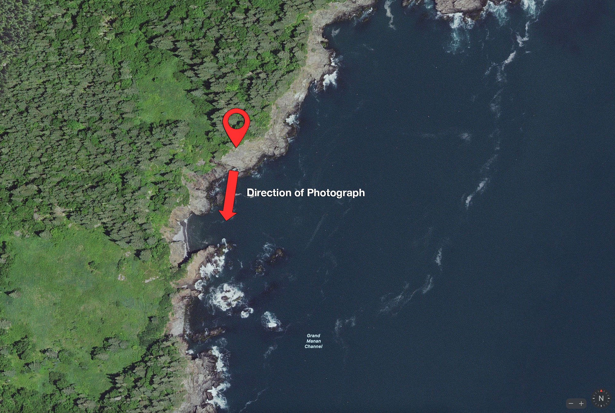
Direction of the Shot
The direction of the shot is south at 190°.
Equipment Needed
No need for any special photography equipment. However, a polarizing filter will help with the shot.
Number of Other Photographers to Expect
This spot is off of the beaten path and challenging to get to and it would be unusual to see many other people there.
Weather
Cell Service
I have Verizon and cell service is spotty and unreliable at this location.
Area Guides and Workshops
Rick Berk (25 years as a landscape photographer) - offers private group, 1 on 1 and group workshops (BlueHour Photo Ventures) for the Maine and other northeast US area. Rick lives Freeport, Maine and has traveled and photographed the NE for most of his adult life. His outstanding work can be found at www.rickberk.com