
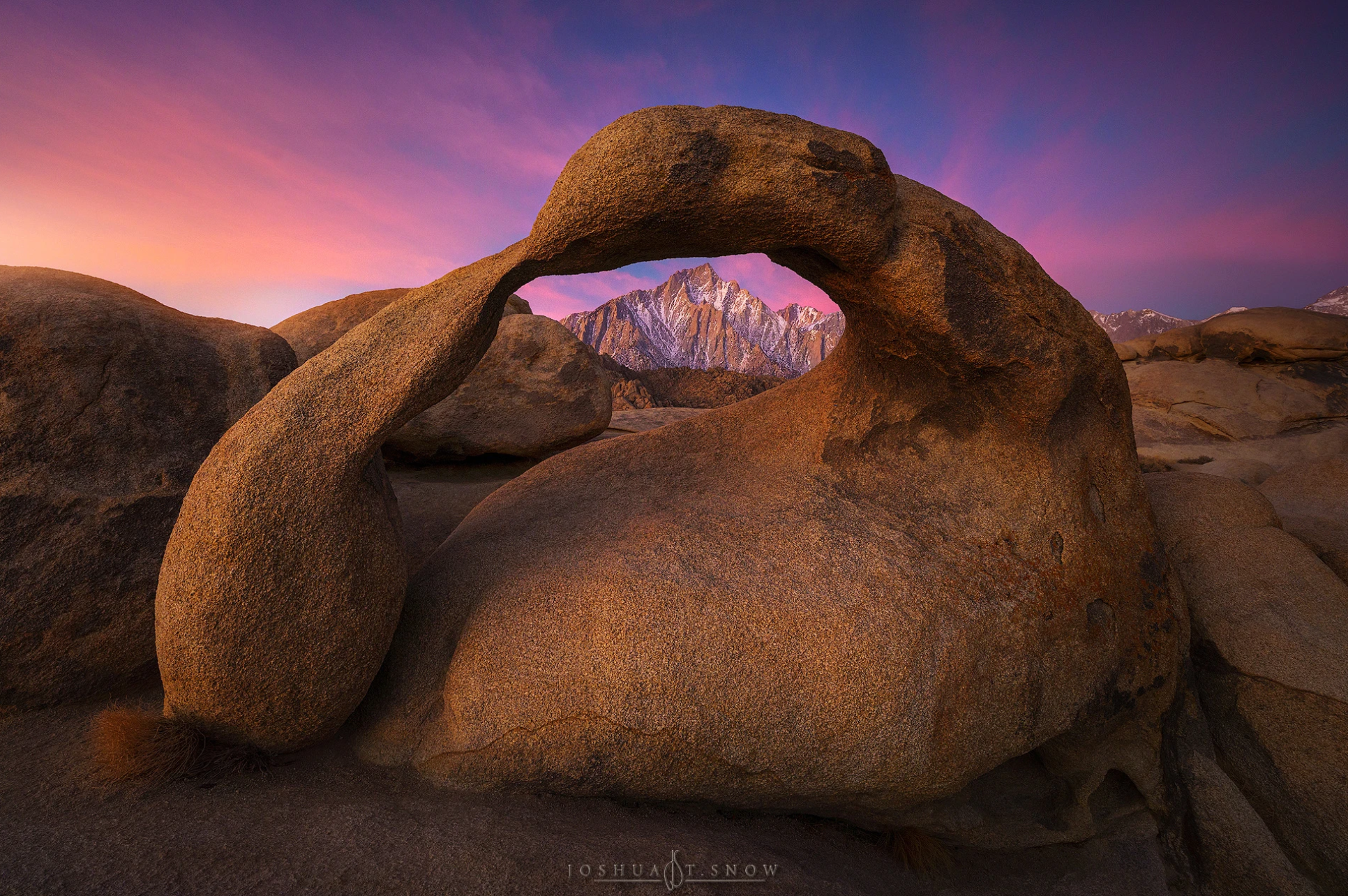
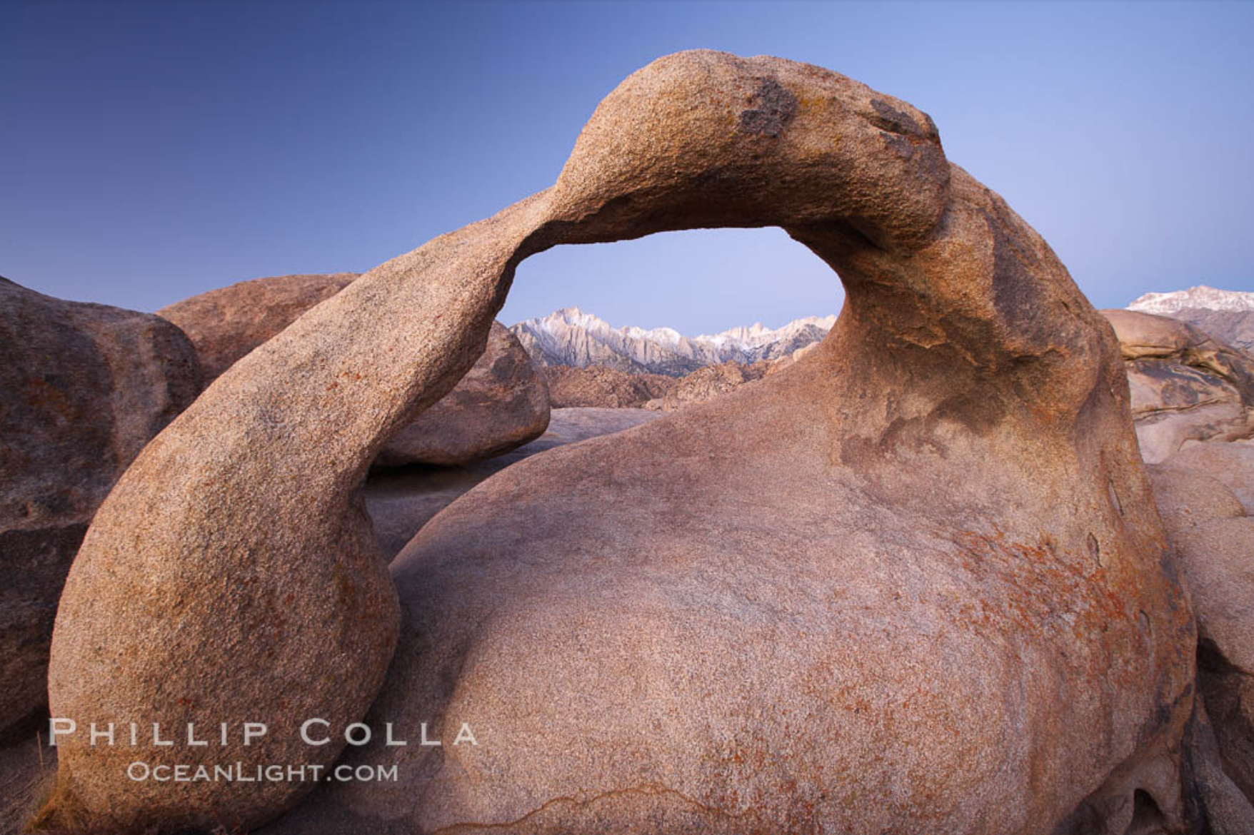
Mobius Arch

MOBIUS ARCH
Alabama Hills - Lone Pine, CA
The Alabama Hills is one the many interesting places located in the Owen River Valley just east of Mt. Whitney and the High Sierras. The location, just a few miles west of Lone Pine, CA, was home to hundreds of old Hollywood western movies over the past 50 years. What make it so interesting for photography are the massive boulders scattered throughout the area, the countless rock formations, and the rolling hills all at the base of the Sierra Mountains.
There are many great landscape opportunities in The Alabama Hills, but my favorite is a natural arch known as Mobius Arch. The 15ft. arch, which is an easy 200yd. hike from Movie Road, provides a unique window view of the majestic Sierras in the background.
Images and location summary by Tim Wier
Trail Difficulty - MODERATE
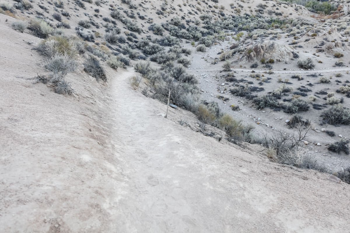
I would rate the difficulty of this trail as a 2 on a scale of 1-5 (with 5 being most difficult). The hike to the Mobius Arch is a fairly easy 200yd. walk on a well-maintained trail. The trail drops down about 50 feet at the beginning and then goes up another 75 feet to the arch.
GPS Coordinates & Elevation
4,677ft Elevation
View In Google earth
Download KMZ Trail File
Click Here to download the KMZ file for this location.
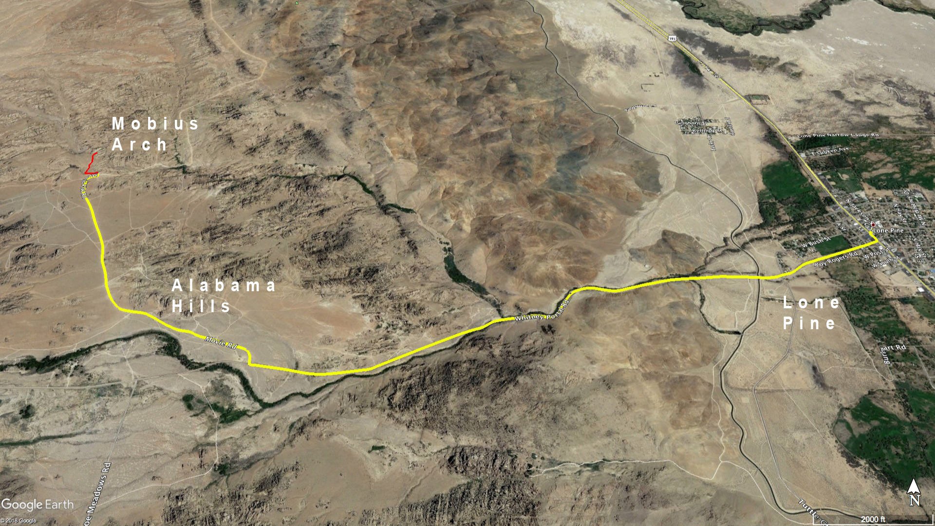
Directions
CLICK HERE to get driving directions to the Mobius Arch parking lot.
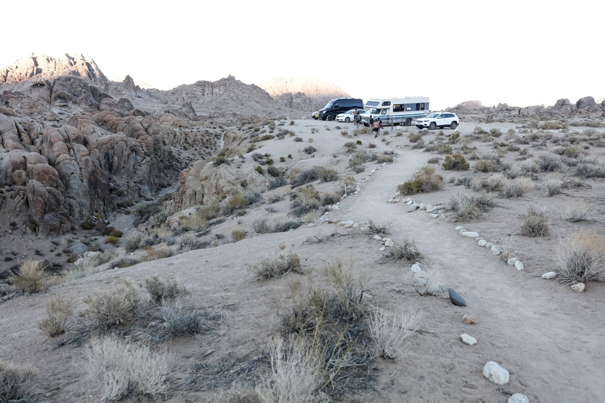
Directions from Lone Pine: Take Whitney Portal Rd. for 2.7 miles and turn right on Movie Rd/Movie Flat Rd. (starts out paved and quickly turns to dirt/gravel). Drive 1.6 miles. When you come to a fork in the road, turn right. After about 100yds., there is a dirt parking lot on the left. This is the trailhead to Mobius Arch.
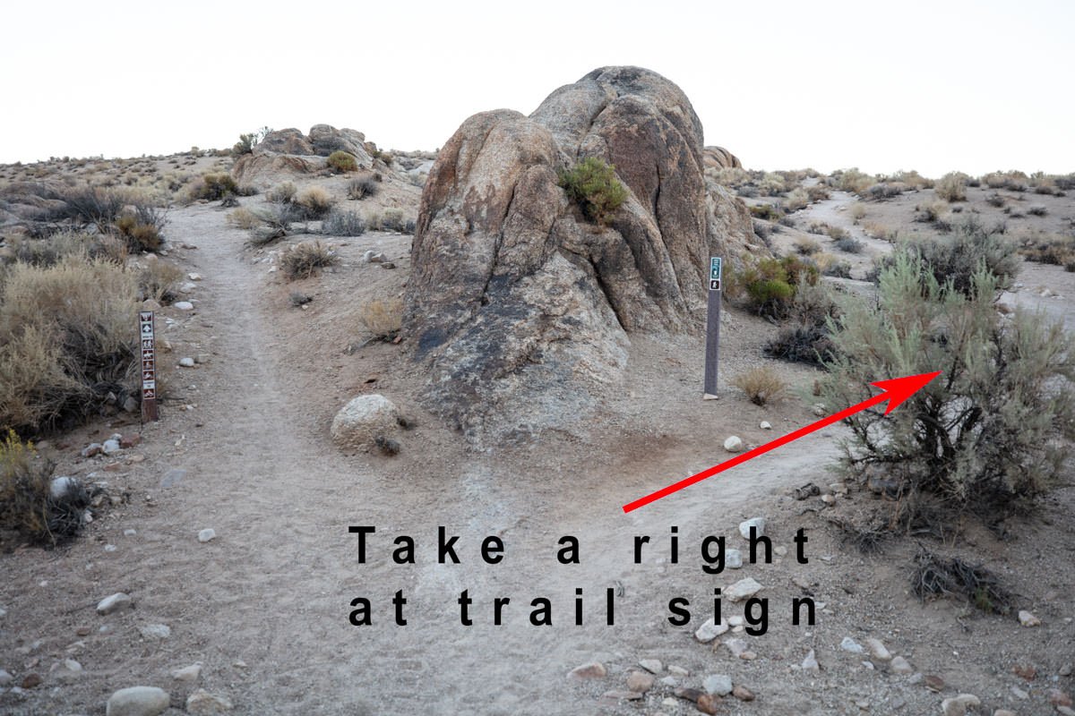
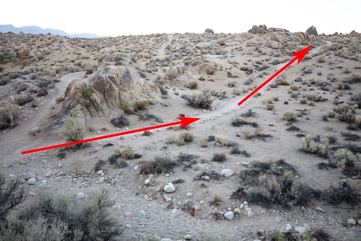
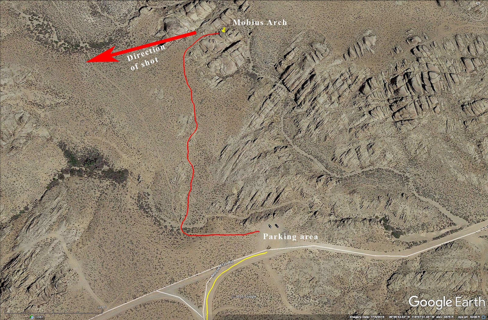
The trail to the Mobius Arch is actually a loop. The easiest way to the arch is to start the hike on the left side of the parking lot. The trail goes downhill for about 50yds and you come to a small wash. At the wash there is a split in the trail. Stay right at the “Arch Loop Trail” sign and walk uphill for about 500yds or so and you come to a clump of rocks. Once you reach the clump of rocks, continue on for 10-15ft. or so and the arch is on the right. The total hike is about 1/2 mile.
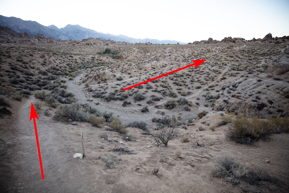
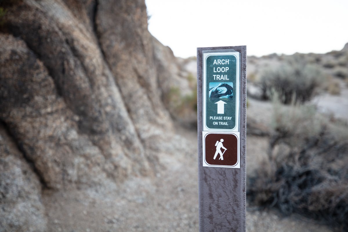
Worth noting: the first time I visited Mobius Arch was for sunrise and we did not see the “Arch Loop Trail” sign at the bottom of the wash. We walked for 2-3 miles before figuring we had taken the wrong route. By the time we got to the real Mobius Arch, we missed sunrise.
If you have walked more than a 1/2 mile, you have gone too far.
Photography Tips
The unique shape and view through the arch are something that usually takes time to compose. The classic shot through the arch with the Sierras in the background is pretty straightforward. But there are many other angles to explore.
EXIF Data
Focal Length – 11 mm
Exposure – 60 sec @ f 8.0
ISO – 100
Date – Jan 19th
Time – 8:28 am
Other Images From This Location
Best Time of Day to Shoot
Most people photograph the Mobius Arch at sunrise. However, sunset and night photography are great ways to shoot this location.
Best Time of Year
This location can be photographed anytime of year. However, with the Sierras in the background, they look great with snow on them in the winter months.
Lens(es) Needed
You can shoot this location with an ultra-wide to wide-angle lens. The shot above was taken with an 11mm lens.
Birds-Eye View
Permits
The Alabama Hills is located on BLM land and at this time, there are no permits required in the area.
Direction of the Shot
The direction of the shot is west around 240°.
Equipment Needed
Other than a tripod, no other special equipment is needed
Number of Other Photographers to Expect
The Mobius Arch is one of the most photographed spot in The Alabama Hills, and the area to stand while photographing it is very small (you are standing on another rock/boulder looking through the arch). Rarely will you be the only photographer wanting to get a great sunset shot. If you want to make sure you have a spot, arrive early to claim it.
Weather
The weather in Lone Pine is modest with lows in the winter reaching the low 20s.
Cell Service
I have Verizon and I had limited cell service while in the Alabama Hills. The cell service is stronger in Lone Pine, CA.
Lodging & Camping
The closest town to the Alabama Hills in Lone Pine, CA. It is a small town, but it’s a pass-through for tourists driving from Los Angles to Mammoth Mountain, so there are several hotels.
Camping in Alabama Hills is still free (as it is on BLM land). However, they have greatly reduced the number of camping spots available. NOTE: this area is VERY popular at certain times of the year and especially on the weekends - so camping locations can sometimes be hard to find. There is a fairly nice campground in Lone Pine called Portagee Joe Campground.
Nearby camping and lodging
Camping - click on the campground below for directions
Portagee Joe Campground (on the west part of Lone Pine)
Lodging - click on the lodging below for a TripAdvisor review
Whitney Portal Hostel
(760) 876-0030
238 S Main, Lone Pine, CA
Best Western Plus Frontier Motel
(760) 876-5571
1008 S Main St, Lone Pine, CA
Comfort Inn
(760) 876-8700
1920 S Main St, Lone Pine, CA
Nearby Restaurants
There are several restaurants in the little town of Lone Pine. For breakfast or lunch I like either the Alabama Hills Café or The Grill. For dinner, the Seasons Restaurant is my go-to place. It is more upscale and expensive, but has a nice menu and good food. Another very good option is Castro’s Taco Stand (right on main street) - they have great street tacos at a good price.
Nearby Restaurants - click on the restaurant below for yelp review
Alabama Hills Cafe & Bakery
(760) 876-4675
111 W Post, Lone Pine, CA
Seasons Restaurant
(760) 876-8927
206 S Main St, Lone Pine, CA
The Grill
(760) 876-4240
446 S Main St, Lone Pine, CA
Area Guides and Workshops
None